
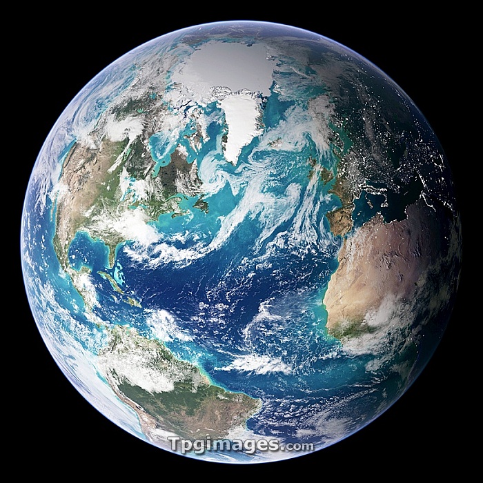
Blue Marble image of Earth. Composite satellite image of Earth's western hemisphere, centred on the Atlantic Ocean. North is at top. The image is one of a set entitled Blue Marble: Next Generation, released in October 2005, which improves upon Blue Marble 2000. The new images combine data collected over a longer period of time at an improved resolution of 500 metres per pixel. Features include cloud cover, oceans, phytoplankton activity, topography, and city lights in the nighttime part of the hemisphere. Data was obtained mainly by NASA's Moderate Resolution Imaging Spectroradiometer (MODIS) aboard the Terra and Aqua satellites between July 2001 and July 2004. Topography is based on radar data collected by the Space Shuttle Endeavor.
| px | px | dpi | = | cm | x | cm | = | MB |
Details
Creative#:
TPG05323643
Source:
達志影像
Authorization Type:
RF
Release Information:
須由TPG 完整授權
Model Release:
NO
Property Release:
NO
Right to Privacy:
No
Same folder images:
 Loading