
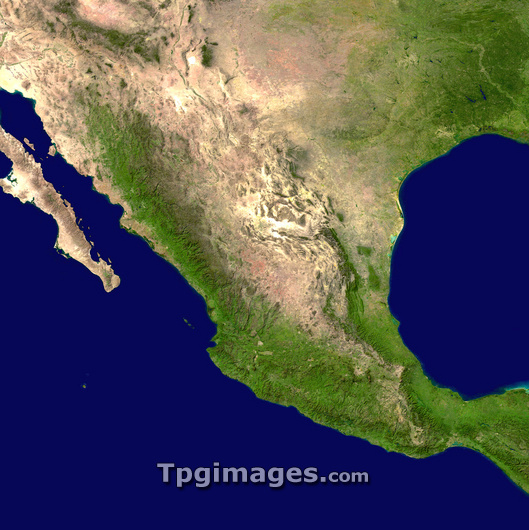
Mexico, true-colour satellite image. North is at top. The land in this image is divided between the USA (across top and at upper right) and Mexico (rest of the image), with the Pacific Ocean at lower left, and the Gulf of Mexico at centre right. The Sierra Madre mountains run north-south through Mexico. The climate varies from arid deserts (brown) to lush tropical vegetation (green) in Mexico's west and south. The Baja Peninsula is at far left, the deserts of the US South-West are at top left, and the states of Texas (green and brown) and Louisiana (dark green) at upper right. The area shown here is around 2200 kilometres wide. Image obtained using the MODIS sensors. MODIS sensors are carried on the Terra and Aqua satellites.
| px | px | dpi | = | cm | x | cm | = | MB |
Details
Creative#:
TOP03206501
Source:
達志影像
Authorization Type:
RM
Release Information:
須由TPG 完整授權
Model Release:
N/A
Property Release:
N/A
Right to Privacy:
No
Same folder images:
 Loading