
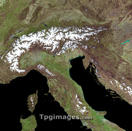
The Alps, true-colour satellite image. North is at top. The Alps (white, upper frame) are the major mountain range in Europe. The countries that surround the Alps are, clockwise from upper left: France, Switzerland, Germany, Austria, Slovenia and Italy. This image includes the whole of Switzerland, Austria and Slovenia, the southern parts of Germany, south-eastern parts of France, and the northern and central parts of Italy. Other, non-Alpine countries at upper and centre right include parts of Slovakia and Hungary, and most of Croatia and Bosnia. The area shown in this image is around 1000 kilometres wide. Image obtained using the MODIS sensors. MODIS sensors are carried on the Terra and Aqua satellites.
| px | px | dpi | = | cm | x | cm | = | MB |
Details
Creative#:
TOP03208320
Source:
達志影像
Authorization Type:
RM
Release Information:
須由TPG 完整授權
Model Release:
N/A
Property Release:
N/A
Right to Privacy:
No
Same folder images:
 Loading