
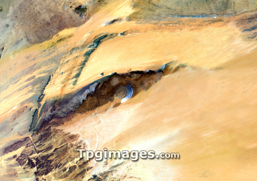
Richat Structure, Mauritania, satellite image. North is at top. The Richat Structure (just left of centre) is a geological formation in the Sahara's Maur Adrar Desert in Mauritania. Although it resembles an impact crater, the Richat Structure formed when a volcanic dome hardened and gradually eroded, exposing the onion-like layers of rock. The structure's diameter is about 50 kilometres. Image data obtained on 13 January 1987.
| px | px | dpi | = | cm | x | cm | = | MB |
Details
Creative#:
TOP03208668
Source:
達志影像
Authorization Type:
RM
Release Information:
須由TPG 完整授權
Model Release:
N/A
Property Release:
N/A
Right to Privacy:
No
Same folder images:
 Loading