
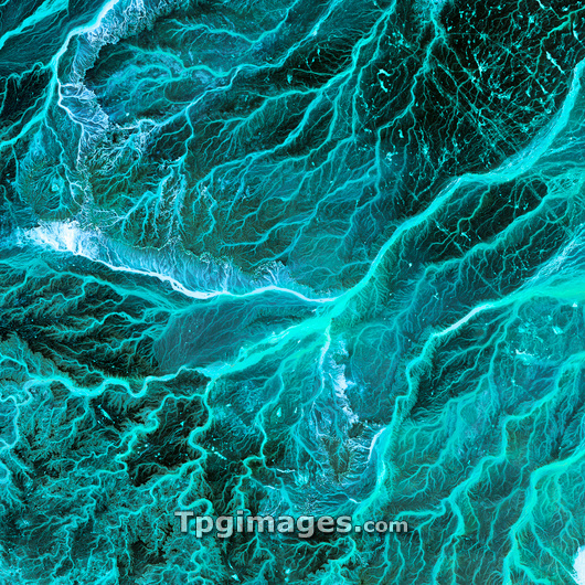
Dry river beds, satellite image. North is at top. The bright blue areas are meandering wadis (dry river beds) that have formed in this desert area due to flooding. Desert areas can go for years without rain, and then be flooded by large storms. The floodwaters briefly carve patterns in the landscape and then evaporate or sink into the soil. The bright blue areas have higher moisture content than the surrounding areas. This area is in eastern Jordan, near the Syrian border. The area shown in this image is around 60 kilometres wide. The image data includes infrared wavelengths, and was obtained on 17 May 2001, using the ASTER sensor on the Terra satellite.
| px | px | dpi | = | cm | x | cm | = | MB |
Details
Creative#:
TOP03208674
Source:
達志影像
Authorization Type:
RM
Release Information:
須由TPG 完整授權
Model Release:
N/A
Property Release:
N/A
Right to Privacy:
No
Same folder images:
 Loading