
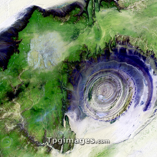
Richat Structure, satellite image. North is at top. Desert sands are pale yellow/white (top left and lower right), while less sandy, rocky areas are green, and volcanic rocks are blue. The Richat Structure is an eroded volcanic dome in the deserts of Mauritania. As the volcanic dome eroded, these onion-like layers of rock were exposed. The structure is 485 metres high, and nearly 50 kilometres across. It is in the Maur Adrar Desert, in the Western Sahara. The area shown in this image is around 66 kilometres wide. The image data includes infrared wavelengths, and was obtained on 11 January 2001, by the Landsat 7 satellite.
| px | px | dpi | = | cm | x | cm | = | MB |
Details
Creative#:
TOP03208676
Source:
達志影像
Authorization Type:
RM
Release Information:
須由TPG 完整授權
Model Release:
N/A
Property Release:
N/A
Right to Privacy:
No
Same folder images:
 Loading