
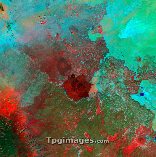
Syrian Desert, satellite image. North is at top. Vegetation is red and dark green, while arid areas of sand and rock are light green and light blue. Water is blue. At centre is Jabal Sis, a huge extinct volcanic crater rising 100 metres above the surrounding plain. This area, part of the Syrian Desert, is in south-western Syria, near the border with Jordan. The water flow patterns on the landscape are evidence of seasonal flooding that supports the sparse vegetation in this area. The area shown in this image is around 100 kilometres wide. The image data includes infrared wavelengths, and was obtained on 6 November 2000, by the Landsat 7 satellite.
| px | px | dpi | = | cm | x | cm | = | MB |
Details
Creative#:
TOP03208679
Source:
達志影像
Authorization Type:
RM
Release Information:
須由TPG 完整授權
Model Release:
N/A
Property Release:
N/A
Right to Privacy:
No
Same folder images:
 Loading