
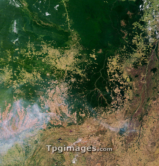
Deforestation in Brazil, satellite image 1 of 2. This image was taken in 2002 by the Moderate Resolution Imaging Spectroradiometer (MODIS) on NASA's Terra satellite. It shows an area of the Amazon rainforest (dark green) in the Brazilian state of Mato Grasso, which in recent years has been subjected to massive deforestation to generate land for agriculture (light green and brown). It was estimated by the Brazilian government that 48 per cent of Amazon deforestation in 2003 and 2004 took place in Mato Grasso. Deforestation destroys biodiversity, leads to increased soil erosion and may contribute to climate change. The extent of the damage can be seen by comparing with image E640/671 which shows the same area in 2006.
| px | px | dpi | = | cm | x | cm | = | MB |
Details
Creative#:
TOP03208775
Source:
達志影像
Authorization Type:
RM
Release Information:
須由TPG 完整授權
Model Release:
N/A
Property Release:
N/A
Right to Privacy:
No
Same folder images:
 Loading