
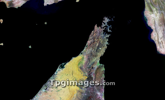
Musandam Peninsula, Oman, satellite image. North is at top. This peninsula separates the Persian Gulf (left) from the Gulf of Oman (right), and forms the southern coastline of the Strait of Hormuz (top centre). This is a strategically important area in the Middle East, as it is the only passage to the open sea for oil exported from the Persian Gulf states. The strait is only 34 kilometres wide at its narrowest point. The northern coastline is part of Iran. The peninsula is separated from the rest of Oman (not seen) by the land at lower centre, which is part of the United Arab Emirates. Most of the terrain is rocky, but desert sands (yellow) surround the coastal cities of Sharjah and Dubai (lower left). Image from the Landsat 7 satellite.
| px | px | dpi | = | cm | x | cm | = | MB |
Details
Creative#:
TOP03208863
Source:
達志影像
Authorization Type:
RM
Release Information:
須由TPG 完整授權
Model Release:
N/A
Property Release:
N/A
Right to Privacy:
No
Same folder images:
 Loading