
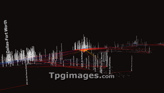
World air traffic, computer artwork. This visualisation is based on the flight schedules of over 30 airline companies. Square dots represent airports and the vertical words are airport names with their international standard abbreviation. The height of the airport name represents the number of departures from that airport. The lines connecting the airports represent the flight route taken by airplanes. This image shows the progress of flights at one particular moment during the day. The low oblique viewing angle shows North and South America in the foreground with Europe in the centre, Africa and Asia towards the background (middle to far right). Image created by Christian Riekoff using Flighttracker software.
| px | px | dpi | = | cm | x | cm | = | MB |
Details
Creative#:
TOP03227443
Source:
達志影像
Authorization Type:
RM
Release Information:
須由TPG 完整授權
Model Release:
N/A
Property Release:
N/A
Right to Privacy:
No
Same folder images:
 Loading