
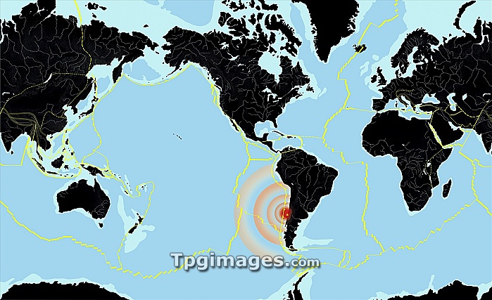
Chile 2010 earthquake. World map showing the location and seismic waves (red concentric circles) of the large 8.8 moment magnitude earthquake that struck off the coast of Chile on 27 February 2010. This was one of the largest earthquakes ever. Several hundred people died and there were many powerful aftershocks. The map also shows the boundaries (yellow lines) of the tectonic plates that make up the Earth's crust, the continents (black), the oceans (blue) and the continental shelves (light blue). Tectonic plates move over the molten rock below them, colliding with and moving past, under and over each other. Immense pressures can build up, which are released during an earthquake.
| px | px | dpi | = | cm | x | cm | = | MB |
Details
Creative#:
TOP06663824
Source:
達志影像
Authorization Type:
RM
Release Information:
須由TPG 完整授權
Model Release:
NO
Property Release:
NO
Right to Privacy:
No
Same folder images:
 Loading