
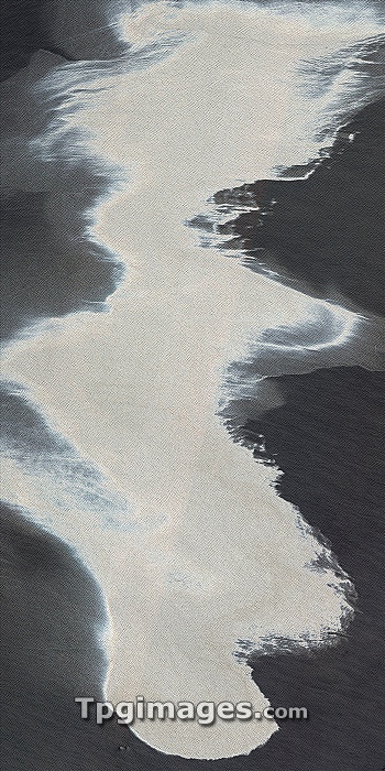
Gulf of Mexico oil spill. Satellite image of an oil spill (white area) in the Gulf of Mexico. This spill followed a blowout that caused an explosion on the mobile offshore drilling unit Deepwater Horizon, which then sank off the coast of Louisiana. The oil spill, originating from the blowout 1,500 metres below sea level, is releasing an estimated 42,000 gallons (160,000 litres) of oil into the sea each day. Image captured by the Moderate Resolution Imaging Spectroradiometer (MODIS) on NASA?a?s Aqua satellite, and the Advanced Land Imager on NASA's Earth Observing satellite, on 25th April 2010.
| px | px | dpi | = | cm | x | cm | = | MB |
Details
Creative#:
TOP06666416
Source:
達志影像
Authorization Type:
RM
Release Information:
須由TPG 完整授權
Model Release:
NO
Property Release:
NO
Right to Privacy:
No
Same folder images:
 Loading