
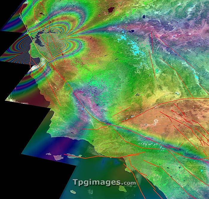
San Francisco earthquake risk forecast. Satellite image of California, USA, showing earthquake faults (red lines) and synthetic aperture radar patterns of seismic deformations resulting from a model earthquake on the San Andreas fault (yellow line). The changes in colour represent the displacement of the ground due to the earthquake. The model has estimated that there is a 25 per cent chance of an earthquake measuring magnitude 7 or above in the next 20 years along the San Andreas fault.
| px | px | dpi | = | cm | x | cm | = | MB |
Details
Creative#:
TOP06673543
Source:
達志影像
Authorization Type:
RM
Release Information:
須由TPG 完整授權
Model Release:
NO
Property Release:
NO
Right to Privacy:
No
Same folder images:
sanandreasfaultsanfranciscomapearthquakecitynorthamericausacaliforniaanalysingpredictingmodellingearthobservationgeographyseismologysatelliteimagesatellitevirtualcaliforniacomputersimulationcomputermodelfaultsystemssyntheticapertureradarpatternpatternsdeformationdeformationsfaultscoastlinecoastalforecastriskpredictiondisplacementunitedstatesamericangeographical"
"americaamericananalysingandreasaperturecaliforniacaliforniacitycoastalcoastlinecomputercomputerdeformationdeformationsdisplacementearthearthquakefaultfaultfaultsforecastfranciscogeographicalgeographyimagemapmodelmodellingnorthobservationpatternpatternspredictingpredictionradarrisksansansatellitesatelliteseismologysimulationstatessyntheticsystemsunitedusavirtual
 Loading