
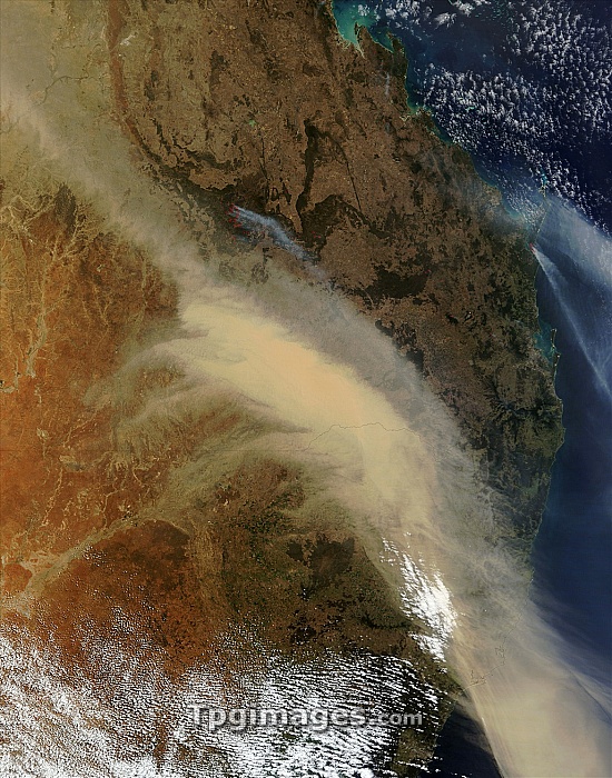
Australian bushfires, satellite image. North is at top. This image, several hundred kilometres across, shows part of Australia's eastern coast, with Brisbane at far centre right. A large plume of dust (light brown) covers much of the central and lower right area, showing the prevailing winds blowing to the south-east. Fires (red, upper right and upper left) have smoke (grey) trailing from them. Also shown are clouds (white, bottom) and the state boundary line (across centre) between Queensland (top) and New South Wales (bottom). Image obtained at 00:35 UTC (10:35 local time) on 26 September 2009, by NASA's Terra satellite.
| px | px | dpi | = | cm | x | cm | = | MB |
Details
Creative#:
TOP07420746
Source:
達志影像
Authorization Type:
RM
Release Information:
須由TPG 完整授權
Model Release:
NO
Property Release:
NO
Right to Privacy:
No
Same folder images:
 Loading