
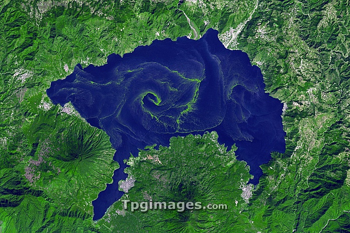
Lake Atitlan algal bloom, Guatamala highlands, satellite image. North is at top. This is an endorheic basin, meaning that water flows here from the surrounding mountains rather than to the sea. The green swirls in the lake are blooms of cyanobacteria (blue-green algae) caused by rainwater carrying sewage and fertilisers into the lake from the surrounding area, which includes several settlements (grey). The lake is some 19 kilometres across. At lower left is the San Pedro volcano. Image obtained by the Advanced Spaceborne Thermal Emission and Reflection Radiometer (ASTER) on NASA's Terra satellite, on 22 November 2009.
| px | px | dpi | = | cm | x | cm | = | MB |
Details
Creative#:
TOP07420757
Source:
達志影像
Authorization Type:
RM
Release Information:
須由TPG 完整授權
Model Release:
NO
Property Release:
NO
Right to Privacy:
No
Same folder images:
 Loading