
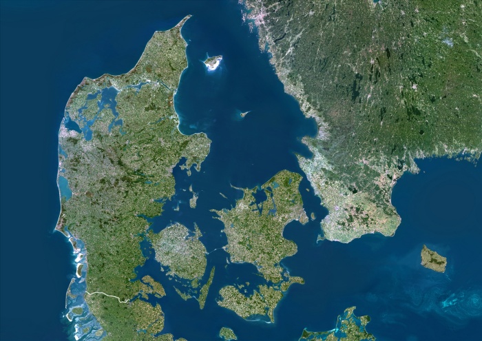
Denmark, True Colour Satellite Image With Border. Denmark, true colour satellite image with border. Denmark comprises the peninsula of Jutland (down centre) and the islands of Funen (centre) and Zealand (centre right), along with many smaller islands. North of these islands and east of Jutland is the Kattegat sea, which separates Denmark from Sweden (upper right). Jutland borders Germany to the south, while the southernmost tip of Norway is at top left. The Baltic Sea is at right, the North Sea is at left. The image used data from LANDSAT 5 & 7 satellites.
| px | px | dpi | = | cm | x | cm | = | MB |
Details
Creative#:
TOP09062908
Source:
達志影像
Authorization Type:
RM
Release Information:
須由TPG 完整授權
Model Release:
NO
Property Release:
NO
Right to Privacy:
No
Same folder images:
 Loading