
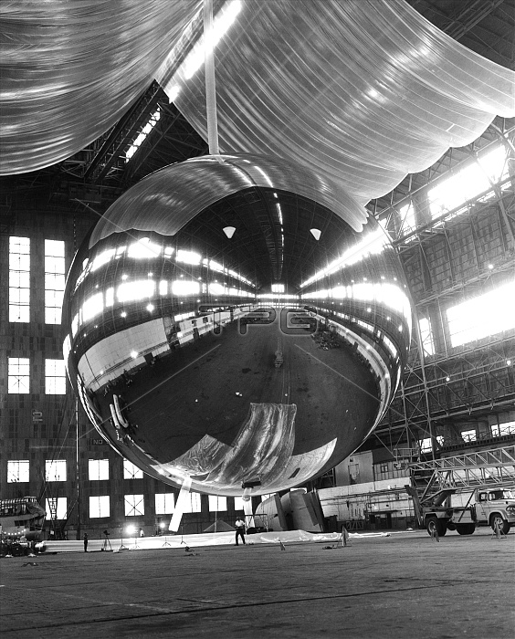
PAGEOS satellite. Inflation test of the Passive Geodetic Satellite (PAGEOS) before its launch. It was used in a geodetic experiment to determine the Earth's shape. It was launched on 24 June 1966 into a circular, polar orbit at an altitude of 4160 kilometres (km). Its 30-metre diameter infla- table reflective sphere made it appear as a point of light in the sky. As it orbited, cameras on the ground simultaneously photographed it against a star background from some of the stations in a worldwide network of 41 sites. By comparing the images, the position of cameras in two stations 4800 km apart could be determined to within 11 metres. PAGEOS slowly broke up during 1975-78.
| px | px | dpi | = | cm | x | cm | = | MB |
Details
Creative#:
TOP10226339
Source:
達志影像
Authorization Type:
RM
Release Information:
須由TPG 完整授權
Model Release:
N/A
Property Release:
N/A
Right to Privacy:
No
Same folder images:
 Loading