
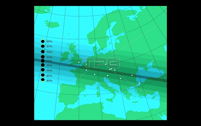
Solar eclipse. Map of Europe showing the pathway of the solar eclipse which passes west to east across the continent on 11 August 1999. The path- way of totality (complete solar eclipse) is dark grey, with areas of partial eclipse on either side of it represented as a percentage of totality. The maximum path width of totality is 112 kilometres, and maximum duration of eclipse is 2 minutes 23 seconds. Major European cities are white dots. At about 10h10 UT the eclipse touches the UK mainland at Cornwall, tracking through France, southern Germany, Austria, Hungary and Romania, before entering the Black Sea (11h10 UT). It occurs when the Moon passes between the Earth and the Sun.
| px | px | dpi | = | cm | x | cm | = | MB |
Details
Creative#:
TOP10239140
Source:
達志影像
Authorization Type:
RM
Release Information:
須由TPG 完整授權
Model Release:
N/A
Property Release:
N/A
Right to Privacy:
No
Same folder images:
 Loading