
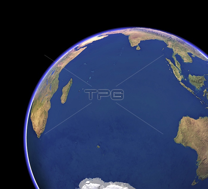
Indian Ocean, cloud-free. Computer graphic of the Indian Ocean on an Earth globe, generated using satellite and mapping data. The data combines cloud-free satellite images of the land and sea surface in natural colour. Exaggerated topographic data is used to show the height of the land surface. Ocean colour variations are due to shallow depth around coasts and islands, and to chlorophyll concentration from phytoplankton near the sea surface. The Indian Ocean is surrounded by Africa (upper left), Asia (across top), Australia (lower right), and Antarctica (bottom centre). Islands include Madagascar, Sri Lanka, the Seychelles, Mauritius, and Kerguelen.
| px | px | dpi | = | cm | x | cm | = | MB |
Details
Creative#:
TOP11247349
Source:
達志影像
Authorization Type:
RM
Release Information:
須由TPG 完整授權
Model Release:
No
Property Release:
No
Right to Privacy:
No
Same folder images:
 Loading