
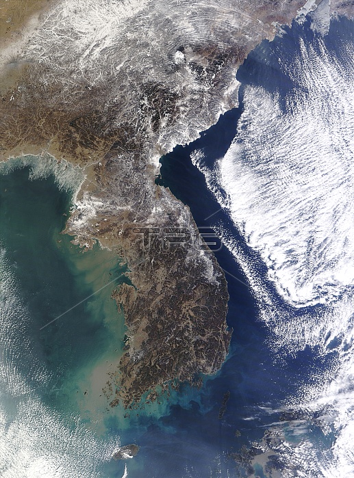
Korean Peninsula, satellite image. North is at top. Vegetation and barren land are dark green and brown in this winter view, while snow, ice and clouds are white. This peninsula is divided between North Korea and South Korea. Across top are parts of China. A high-pressure system has left most of the peninsula cloud free, with clouds held off over the sea to the east (right). Sea ice is visible in Korea Bay at upper left, with ice seen on mountains and rivers along the peninsula. Image data obtained on 30 January 2012 by the Moderate Resolution Imaging Spectroradiometer (MODIS) on NASA's Terra satellite.
| px | px | dpi | = | cm | x | cm | = | MB |
Details
Creative#:
TOP11247512
Source:
達志影像
Authorization Type:
RM
Release Information:
須由TPG 完整授權
Model Release:
No
Property Release:
No
Right to Privacy:
No
Same folder images:
 Loading