
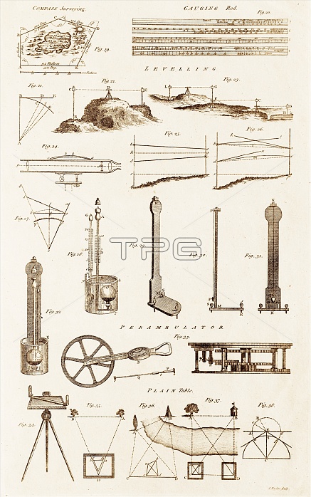
Plate from 18th century encyclopedia showing illustrations of various surveying instruments and techniques. Shown are proceedures for compass surveying, triangulation, and leveling. Instruments shown include; gauging rod, sighting telescope, barometers, perambulator and plain tables. In levelling a typical procedure is to set up the instrument within 100 metres of a point of known or assumed elevation. A rod or staff is held vertical on that point and the instrument is used manually or automatically to read the rod scale. This gives the height of the instrument above the starting (backsight) point and allows the height of the instrument above the datum to be computed.
| px | px | dpi | = | cm | x | cm | = | MB |
Details
Creative#:
TOP11720278
Source:
達志影像
Authorization Type:
RM
Release Information:
須由TPG 完整授權
Model Release:
NO
Property Release:
NO
Right to Privacy:
No
Same folder images:
 Loading