
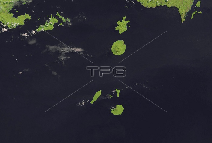
Krakatau. Landsat 8 satellite image of Krakatau volcano (bottommost island), in the Sunda Strait, Indonesia. A massive eruption of Krakatau in August 1883 destroyed two-thirds of the 9 kilometre long island. The explosion was heard over 4000 kilometres away and is considered the loudest sound in recorded history. Over 36,000 people were killed and 163 villages destroyed, mainly by tsunamis that hit the surrounding coastlines of Sumatra (upper right) and Java. A young volcano (in the centre of the 3 islands), called Anak Krakatau (child of Krakatau), has formed from the ruins of Krakatau. Image obtained by Landsat 8's Operational Land Imager (OLI), in August 2013.
| px | px | dpi | = | cm | x | cm | = | MB |
Details
Creative#:
TOP13924930
Source:
達志影像
Authorization Type:
RM
Release Information:
須由TPG 完整授權
Model Release:
N/A
Property Release:
No
Right to Privacy:
No
Same folder images:
 Loading