
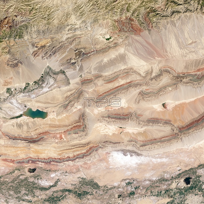
Keping Shan thrust belt. Satellite image of the Keping Shan thrust belt, just south of the Tien Shan mountains, Xinjiang province, China. This region is dominated by a series of ridges, with the highest hills rising up to 1200 metres and decorated with distinctive red, green and cream-coloured sedimentary rock layers. The colours reflect rocks that formed at different times and in different environments. Red is Devonian sandstone formed by rivers, Green is Silurian sandstone formed in a moderately deep ocean, and the cream-coloured rock is Cambrian-Ordovician limestone, formed in a shallow ocean. Imaged by the Operational Land Imager (OLI) on the Landsat 8 satellite, on 30th July 2013.
| px | px | dpi | = | cm | x | cm | = | MB |
Details
Creative#:
TOP14563611
Source:
達志影像
Authorization Type:
RM
Release Information:
須由TPG 完整授權
Model Release:
N/A
Property Release:
No
Right to Privacy:
No
Same folder images:
 Loading