
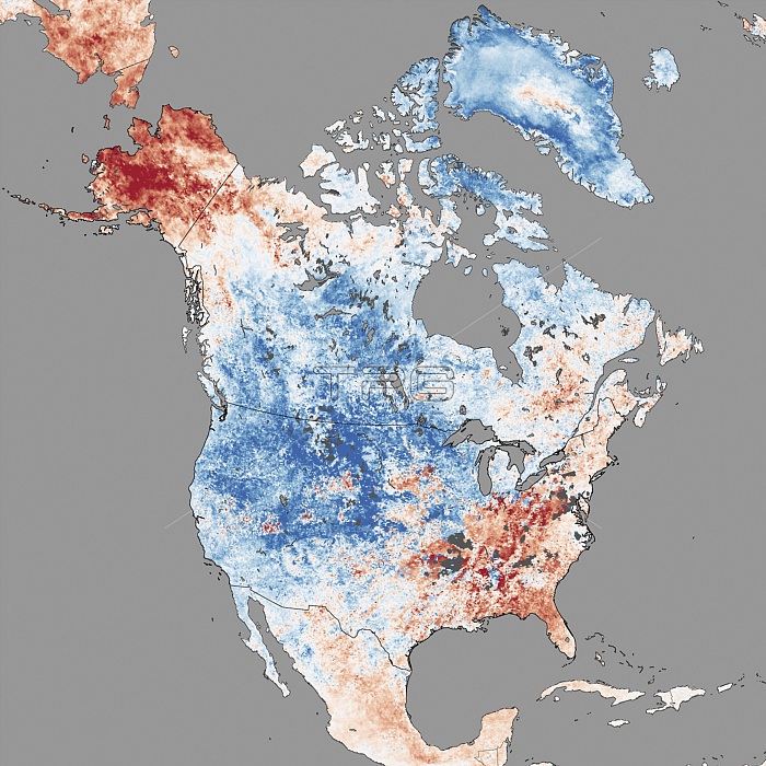
North America temperatures, December 2013. Map of land surface temperatures, showing the sharp contrast between Alaska and the western USA that occurred between 3rd and 10th December 2013. Coldest areas are blue and hottest are red. Whilst much of the continental USA experienced an abnormally cold spell during this period, Alaska basked in record-breaking heat. These extremes were caused by an unusual 'kink' in the polar jet stream, which caused cold Arctic air to move south and warm air to head north. Image based on data acquired by the Moderate Resolution Imaging Spectroradiometer (MODIS) on NASA's Terra satellite.
| px | px | dpi | = | cm | x | cm | = | MB |
Details
Creative#:
TOP14563615
Source:
達志影像
Authorization Type:
RM
Release Information:
須由TPG 完整授權
Model Release:
N/A
Property Release:
No
Right to Privacy:
No
Same folder images:
 Loading