
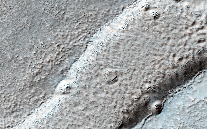
Mesa on Mars, satellite image. This mesa on Mars has a pitted surface due to processes involving the sublimation of ice deposits causing degradation of the rocks. A mesa is an elevated area of land with a flat top and steep sides. It is usually formed by erosion of the surrounding rocks, and this mesa may be the last remnants of a more extensive formation. This image, published in 2013, was obtained by the High Resolution Imaging Science Experiment (HiRISE) instrument on NASA's Mars Reconnaissance Orbiter (MRO) satellite.
| px | px | dpi | = | cm | x | cm | = | MB |
Details
Creative#:
TOP14868006
Source:
達志影像
Authorization Type:
RM
Release Information:
須由TPG 完整授權
Model Release:
N/A
Property Release:
No
Right to Privacy:
No
Same folder images:
 Loading