
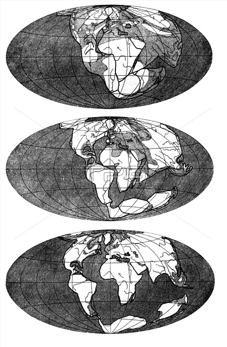
MAP: PANGAEA. /nIllustration depicting Alfred Wegener's theory of the supercontinent Pangaea and how it split to form the present-day continents, from the 4th edition of his *Origin of Continents and Oceans*, 1929.
| px | px | dpi | = | cm | x | cm | = | MB |
Details
Creative#:
TOP16120417
Source:
達志影像
Authorization Type:
RM
Release Information:
須由TPG 完整授權
Model Release:
No
Property Release:
No
Right to Privacy:
No
Same folder images:
 Loading