
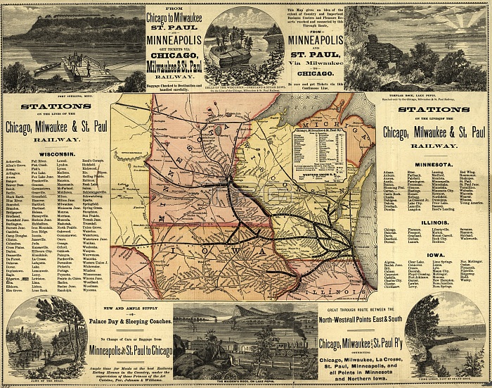
MAP: RAILWAY, 1874. /nA map of the Chicago, Milwaukee, and St. Paul railways, with illustrations. Map by Rand McNally & Co., 1874.
| px | px | dpi | = | cm | x | cm | = | MB |
Details
Creative#:
TOP16149399
Source:
達志影像
Authorization Type:
RM
Release Information:
須由TPG 完整授權
Model Release:
No
Property Release:
No
Right to Privacy:
No
Same folder images:
 Loading