
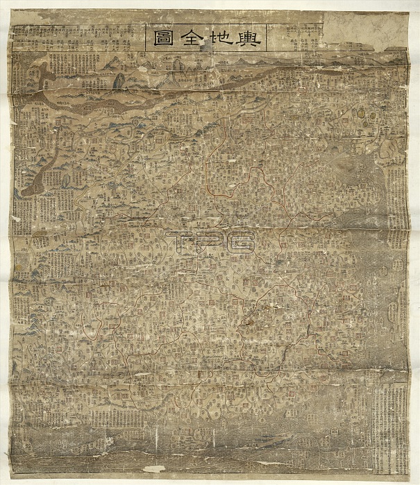
Map of China. 17th-century map of China, covering an area from the Tula River and Great Wall of China in the north (top) to the Wanlishitang Islands in the South China Sea in the south (bottom), and from Korea in the east (right) to the Pamirs in the west (left). The islands at top left represent European and African regions known to the Chinese. Notes on the borders describe the language, habits, and customs of foreign countries, their distance from China, and the routes that mariners must take. Different types of cities and military posts are also shown, with notes on the different provinces. Titled 'Yu di quan tu' (top centre), this map dates from 1673.
| px | px | dpi | = | cm | x | cm | = | MB |
Details
Creative#:
TOP16313443
Source:
達志影像
Authorization Type:
RM
Release Information:
須由TPG 完整授權
Model Release:
N/A
Property Release:
N/A
Right to Privacy:
No
Same folder images:
 Loading