
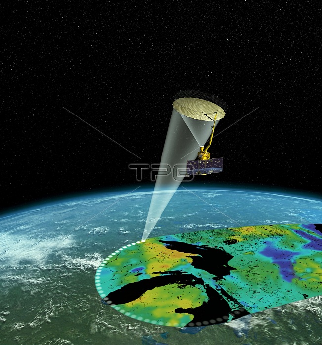
SMAP satellite. Illustration of the operation of the Soil Moisture Active Passive (SMAP) satellite, mapping the Earth's surface. This orbiting observatory measures the amount of water in the top 5 centimetres of soil everywhere on Earth's surface. It provides measurements of the soil moisture and freeze-thaw state, completing global coverage every 2 to 3 days. The data it gathers will enhance understanding of links between the terrestrial water, energy, and carbon cycles, and improve weather forecasting, flood prediction and drought monitoring. The SMAP satellite was launched on 31 January 2015.
| px | px | dpi | = | cm | x | cm | = | MB |
Details
Creative#:
TOP16412711
Source:
達志影像
Authorization Type:
RM
Release Information:
須由TPG 完整授權
Model Release:
No
Property Release:
N/A
Right to Privacy:
No
Same folder images:
 Loading