
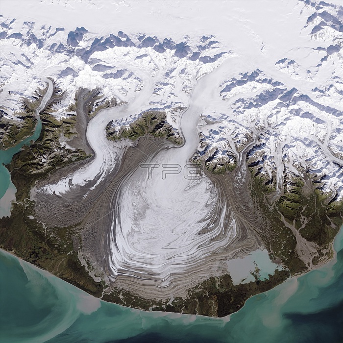
Malaspina Glacier, Alaska, USA. Satellite image of the Malaspina Glacier (centre). The smaller Agassiz glacier is seen to the left of the Malaspina Glacier, and the Marvine and Hayden Glaciers are to the right. The Malaspina Glacier is an example of a piedmont glacier, which spills from a steep valley and spreads out onto a relatively flat plain. It lies west of Yakutat Bay on the Pacific coast near the Alaska-Canada border. The brown lines on the ice are moraines areas where soil, rock, and other debris have been scraped up by the glacier and deposited at its sides. Irregular flow causes the moraines at the edges and between glaciers to become folded, compressed, and sheared. Image data from the Operational Land Imager on Landsat 8, September 24, 2014.
| px | px | dpi | = | cm | x | cm | = | MB |
Details
Creative#:
TOP16412716
Source:
達志影像
Authorization Type:
RM
Release Information:
須由TPG 完整授權
Model Release:
N/A
Property Release:
N/A
Right to Privacy:
No
Same folder images:
 Loading