
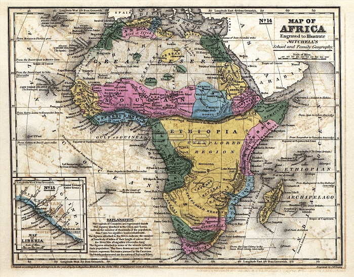
Map of Africa. 19th-century map of the continent of Africa, published in 1839 by US geographer Samuel Augustus Mitchell (1792-1868). The coast of Africa and major rivers were mapped, but large areas of the interior remained unknown until the second half of the 19th century. This map includes population figures (e.g. Cairo 300,000) and river lengths. The country of Liberia (founded by US colonists in 1822) is shown in inset at bottom left. The term 'Ethiopia' is here used to refer to unexplored regions of sub-Saharan Africa, bounded to the north by the legendary Mountains of the Moon. Published in 'Mitchell's School Atlas' (Philadelphia, 1839).
| px | px | dpi | = | cm | x | cm | = | MB |
Details
Creative#:
TOP16426641
Source:
達志影像
Authorization Type:
RM
Release Information:
須由TPG 完整授權
Model Release:
N/A
Property Release:
N/A
Right to Privacy:
No
Same folder images:
 Loading