
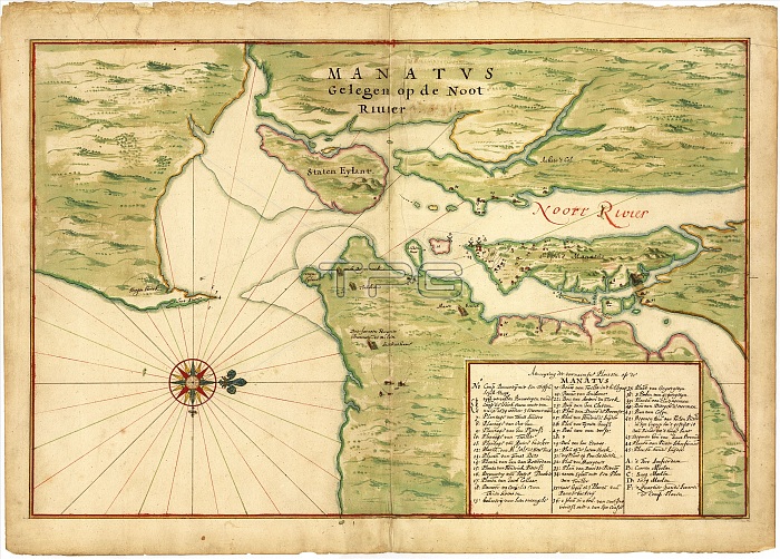
Map of New York Bay. 17th-century map of New York Bay (north towards right), produced in 1670 by Dutch cartographer Johannes Vingboons (c.1616-1670). The first European settlers here were Dutch, part of New Netherland. They established New Amsterdam (later New York City) on Manhattan Island (centre right). At lower right is an index of buildings with the names of the householders. Dutch windmills are shown, as well as the long-houses of indigenous peoples. Staten Island is at upper centre, with the Hudson River and East River at right. Long Island is at lower right. Part of New Jersey is at upper left, with mainland New York at upper right.
| px | px | dpi | = | cm | x | cm | = | MB |
Details
Creative#:
TOP16426654
Source:
達志影像
Authorization Type:
RM
Release Information:
須由TPG 完整授權
Model Release:
N/A
Property Release:
N/A
Right to Privacy:
No
Same folder images:
 Loading