
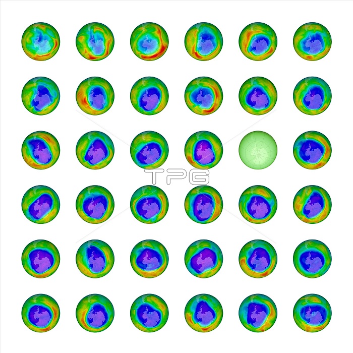
Ozone hole, 1979-2014. Satellite images of the maximum by area (geographical extent) of the ozone hole over Antarctica for each year (except 1995) from 1979 to 2014. The sequence runs from left to right, from top left to bottom right. The maxima occur around early October each year. NASA has been monitoring the status of the ozone layer through satellite observations since the 1970s. Chemicals such as chlorofluorocarbons (CFCs, now banned) caused large decreases in ozone in the stratosphere over Antarctica. This ozone hole increased in size from the late 1970s to the early 21st century, peaking in 2006, but is now thought to have stabilised.
| px | px | dpi | = | cm | x | cm | = | MB |
Details
Creative#:
TOP16629963
Source:
達志影像
Authorization Type:
RM
Release Information:
須由TPG 完整授權
Model Release:
N/A
Property Release:
No
Right to Privacy:
No
Same folder images:
 Loading