
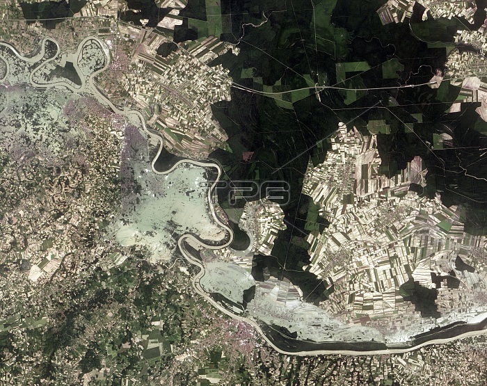
Flooding in the Balkans, satellite image. North is at top. This is a section of the River Sava, forming the border between Bosnia and Herzegovina to the south and Croatia to the north. The town of Brcko is at bottom centre. The light green areas show the devastating flooding that resulted from three days of heavy rain. Fields and wooded areas (dark green) are also visible. More than three million people were affected by the floods. The floods triggered landslides that displaced landmines. Image data obtained on 23 May 2014 by the Advanced Land Imager (ALI) on NASA's Earth Observing-1 (EO-1) satellite.
| px | px | dpi | = | cm | x | cm | = | MB |
Details
Creative#:
TOP16633448
Source:
達志影像
Authorization Type:
RM
Release Information:
須由TPG 完整授權
Model Release:
N/A
Property Release:
N/A
Right to Privacy:
No
Same folder images:
 Loading