
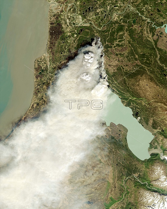
Forest fire, Alaska, satellite image. North is at top. This fire broke out on the Kenai Peninsula, Alaska, USA, on the evening of 19 May 2014, Called the Funny River Fire, it had burned more than 43,000 acres by 17:30 local time on 21 May. In this natural-colour image, smoke is the dominant feature, masking the fire. At upper centre are two pyrocumulonimbus clouds, thunderclouds formed as superheated air rises above an intense fire. Cook Inlet is at upper left, with Tustumena Lake at centre right. This image, some 60 kilometres across, is from the Operational Land Imager (OLI) on the Landsat 8 satellite, 13:13 local time, 20 May 2014. Infrared version: C022/8046.
| px | px | dpi | = | cm | x | cm | = | MB |
Details
Creative#:
TOP16633451
Source:
達志影像
Authorization Type:
RM
Release Information:
須由TPG 完整授權
Model Release:
N/A
Property Release:
N/A
Right to Privacy:
No
Same folder images:
 Loading