
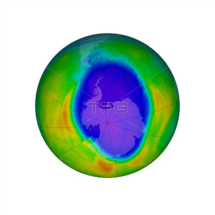
Antarctic ozone hole maximum. Satellite image of the maximum extent in 2016 of the ozone hole (blue) over Antarctica (centre). Ozone layer thicknesses are colour coded from purple (lowest) through blue, cyan and green to yellow (highest). The ozone hole reached its annual maximum on 28 September 2016, covering an area of over 23 million square kilometres. This was similar to the size observed in 2013. The amount of ozone depleting substances have decreased from peak levels in 2000. NASA has been monitoring the status of the ozone layer through satellite observations since the 1970s. Image data obtained by the Ozone Monitoring Instrument on NASA's Aura satellite.
| px | px | dpi | = | cm | x | cm | = | MB |
Details
Creative#:
TOP20028334
Source:
達志影像
Authorization Type:
RM
Release Information:
須由TPG 完整授權
Model Release:
N/A
Property Release:
N/A
Right to Privacy:
No
Same folder images:
 Loading