
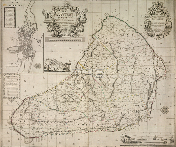
John Sennex.Barbados; A map of Barbados and a plan of Bridgetown.Image taken from A new and Exact map of the island of Barbadoes in America according to an actual & accurate survey in the years 1717 to 1721.Originally published / produced in 1717-1721.1717-1721.From: A new and Exact map of the island of Barbadoes in.Maps. K. Top. 123.117.2. TabLondon; British Library.
| px | px | dpi | = | cm | x | cm | = | MB |
Details
Creative#:
TOP20525539
Source:
達志影像
Authorization Type:
RM
Release Information:
須由TPG 完整授權
Model Release:
No
Property Release:
No
Right to Privacy:
No
Same folder images:
Restriction:
Additional permissions needed for non-editorial use.
 Loading