
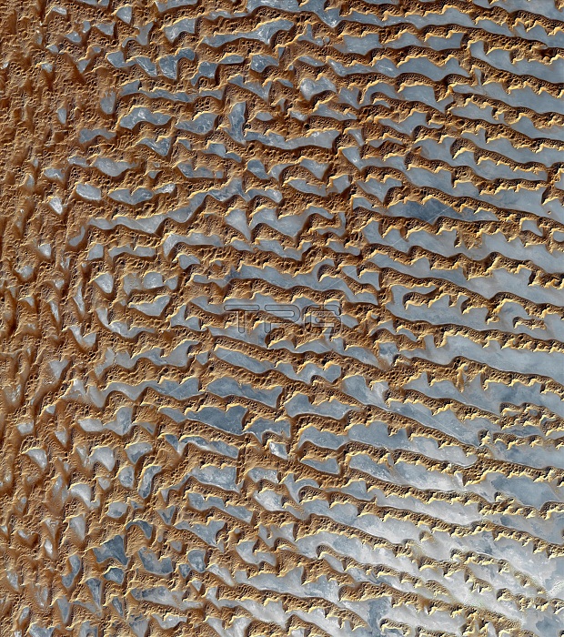
Satellite photograph of the Rub' al Khali, Arabia. This region is one of the largest sand deserts in the world. It covers most of the southern third of the Arabian peninsula and includes parts of Oman, UAE and Yemen. This image was acquired on 2nd December 2005 by the Advanced Spaceborne Thermal Emission and Reflection Radiometer, or ASTER, aboard NASA's Terra Earth-orbiting satellite.
| px | px | dpi | = | cm | x | cm | = | MB |
Details
Creative#:
TOP20890724
Source:
達志影像
Authorization Type:
RM
Release Information:
須由TPG 完整授權
Model Release:
N/A
Property Release:
N/A
Right to Privacy:
No
Same folder images:
 Loading