
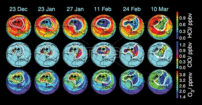
These data maps from Aura's Microwave Limb Sounder depict levels of hydrogen chloride (top), chlorine monoxide (centre), and ozone (bottom) at an altitude of approximately 19 kilometres (490,000 feet) on selected days during the 2004-05 Arctic winter. White contours demark the boundary of the winter polar vortex. The maps from December 23, 2004, illustrate vortex conditions shortly before significant chemical ozone destruction began. Photo via Newscom
| px | px | dpi | = | cm | x | cm | = | MB |
Details
Creative#:
TOP21768082
Source:
達志影像
Authorization Type:
RM
Release Information:
須由TPG 完整授權
Model Release:
No
Property Release:
No
Right to Privacy:
No
Same folder images:
Restriction:
商業用途須申請
 Loading