
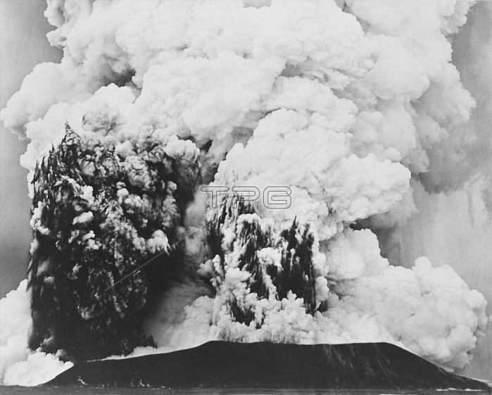
An aerial photograph of Surtsey, a volcanic island near Iceland's southwestern coast, which was formed following an eruption in 1963. Surtsey is a volcanic island located in the Vestmannaeyjar archipelago off the southern coast of Iceland. It was formed in a volcanic eruption which began 426 feet below sea level, and reached the surface on November 14, 1963. The eruption lasted until June 5, 1967, when the island reached its maximum size of 1.0 square mile. Since then, wave erosion has caused the island to steadily diminish in size: as of 2012, its surface area was 0.50 square miles. The most recent survey (2007) shows the island's maximum elevation at 509 feet above sea level.
| px | px | dpi | = | cm | x | cm | = | MB |
Details
Creative#:
TOP22080159
Source:
達志影像
Authorization Type:
RM
Release Information:
須由TPG 完整授權
Model Release:
N/A
Property Release:
No
Right to Privacy:
No
Same folder images:
 Loading