
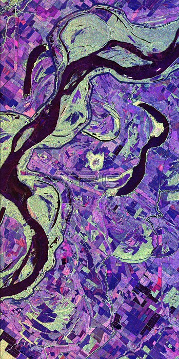
This image of the Mississippi River in Mississippi, Arkansas, and Louisiana shows regions of the southern United States that are prone to flooding. Data acquired by the Spaceborne Imaging Radar-C/X-band Synthetic Aperture imaging radar system, which flew on two space shuttle missions in April and October 1994, can help scientists assess flooding potentials and improve land management for future agricultural development. This image was acquired on October 9, 1994, during orbit 151 of the space shuttle Endeavour.North is toward the upper right of the image.This site along the Mississippi River lies north of Vicksburg along the Arkansas-Louisiana-Mississippi state borders. The river marks the stateline. Louisiana and Arkansas lie above the river and Mississippi is below the river. This region is characterized by rich farmland where a variety of crops are grown. The town located in the extreme upper left hand corner is Eudora, Arkansas. The long, narrow lakes which lie roughly parallel to the river are called oxbow lakes, named for the U-shaped harness worn by an ox. Oxbows are formed when a river changes course, abandoning old channels in favor of a new course. As the river changes course, the surrounding land dries out, leaving these lakes isolated. Oxbow lakes are common in areas where rivers flow through generally flat terrain, allowing the river to easily change course. The green regions bordering the river are undeveloped forested areas.
| px | px | dpi | = | cm | x | cm | = | MB |
Details
Creative#:
TOP22083192
Source:
達志影像
Authorization Type:
RM
Release Information:
須由TPG 完整授權
Model Release:
N/A
Property Release:
No
Right to Privacy:
No
Same folder images:
 Loading