
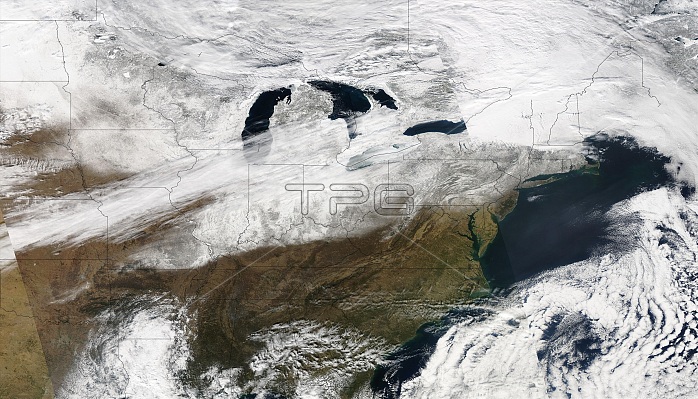
Nearly a week after a winter storm coated a broad swath of the United States with ice and snow, the clouds cleared enough to provide this photo-like view of the winter landscape. The storm, which struck on January 27, 2009, cut off electricity to millions, and by February 2, thousands in Kentucky, Missouri, Illinois, and Arkansas were still without power. This image, captured by the Moderate Resolution Imaging Spectroradiometer (MODIS) on NASA's Aqua satellite on February 1, 2009, show the wide area impacted by the storm. The storm's visible path begins with a wispy line of snow through central Oklahoma and traces north in a solid line from Missouri to Maine. A line of clouds runs parallel to the storm's snowy track, covering parts of the North. Impressive though this swath of snow is, it may not represent the full extent of the storm. Ice is clear, and some may coat the land south of the snow.
| px | px | dpi | = | cm | x | cm | = | MB |
Details
Creative#:
TOP22085385
Source:
達志影像
Authorization Type:
RM
Release Information:
須由TPG 完整授權
Model Release:
N/A
Property Release:
No
Right to Privacy:
No
Same folder images:
 Loading