
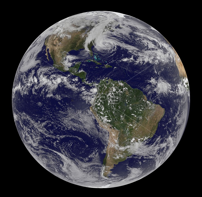
Hurricane Sandy seen from space. Shown are here are how a line of clouds from a continental weather system run south to north along the Appalachian Mountains, approaching from the west to meet the offshore storm. At 2 p.m. EDT, shortly after this image was taken, the U.S. National Hurricane Center reported that Sandy was about 575 miles (930 kilometers) south of New York City. Maximum sustained winds were observed at 75 miles (120 kilometers) per hour, and the barometric pressure at the center of the storm was 951 millibars (28.08 inches). The Geostationary Operational Environmental Satellite 13 (GOES-13) took this image of Hurricane Sandy at 1:45 p.m. EDT on October 28, 2012.
| px | px | dpi | = | cm | x | cm | = | MB |
Details
Creative#:
TOP22089834
Source:
達志影像
Authorization Type:
RM
Release Information:
須由TPG 完整授權
Model Release:
N/A
Property Release:
No
Right to Privacy:
No
Same folder images:
 Loading