
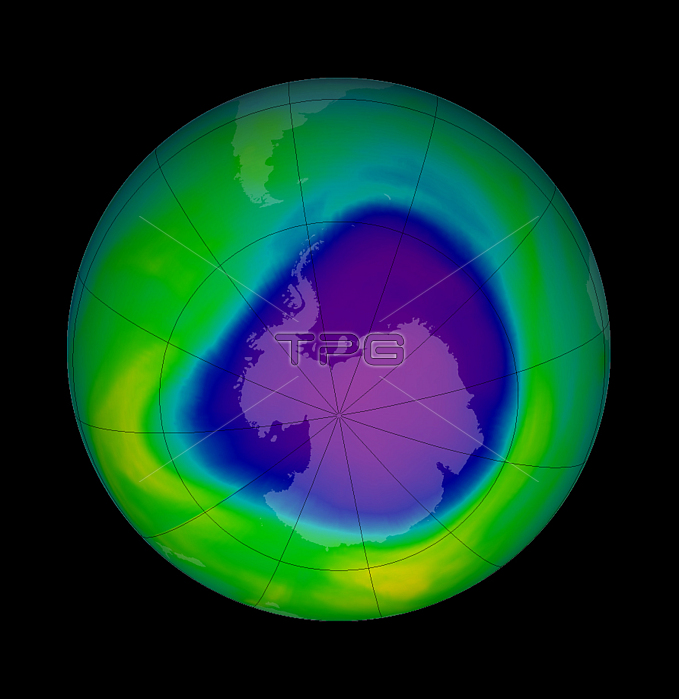
In the early 1980s, scientists began to realize that chlorofluorocarbons, or CFCs, were creating a thin spot, or hole, in the ozone layer over Antarctica. This satellite image shows the ozone hole on the day of its maximum depth for the year of 2005, which occured on September 29. Data was gathered by the Royal Netherlands Meteorological Institute (KNMI) Ozone Monitoring Instrument (OMI), in conjunction with NASA. Purple and dark blue represent the areas where the concenctration of Dobson Units has dropped below 220, with purple being about 110 DU.
| px | px | dpi | = | cm | x | cm | = | MB |
Details
Creative#:
TOP22090034
Source:
達志影像
Authorization Type:
RM
Release Information:
須由TPG 完整授權
Model Release:
N/A
Property Release:
No
Right to Privacy:
No
Same folder images:
 Loading