
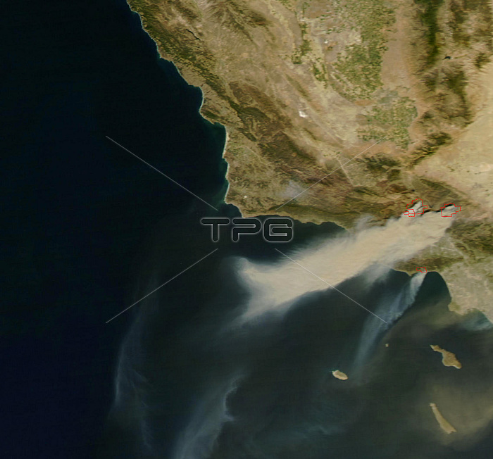
Driven by Santa Ana winds, several large wildfires flared across Southern California over the weekend of October 20, 2007. Image of the area around Los Angeles on October 21, 2007, which show just how rapidly the fires grew. Compare this image to image BH4648, taken by the MODIS on NASA's Terra satellite at 11:35 a.m. local time, which shows several active fires emitting only small plumes of smoke. By contrast, this image, taken at 2:50 p.m., when the Aqua satellite passed overhead, shows smoke pouring from several large blazes northwest of LA. Although MODIS only caught the edge of the scene during this satellite overpass, the plumes of smoke and dust that can be seen blowing off the coast in this image indicate the intensity of the winds and the presence of additional fires farther south. Santa Ana winds are a California firefighter's nightmare. Not only do the winds spread the fire, but they also dry out vegetation, making it even more flammable.
| px | px | dpi | = | cm | x | cm | = | MB |
Details
Creative#:
TOP22309978
Source:
達志影像
Authorization Type:
RM
Release Information:
須由TPG 完整授權
Model Release:
N/A
Property Release:
No
Right to Privacy:
No
Same folder images:
 Loading