
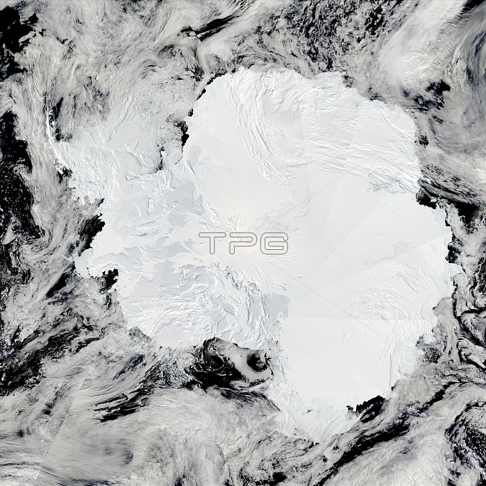
The Moderate Resolution Imaging Spectroradiometer (MODIS) on NASA's u2019s Aqua satellite captured this composite image on January 27, 2009. Few features are visible on the ice-covered landscape. The surface appears rough where the Trans-antarctic Mountains curve in a shallow from the shore of the Ross Sea to the Ronne Ice Shelf. The Polar Plateau in the center of the continent is smooth, shaded only by the faint shadow cast by clouds. The Weddell Sea is textured with chunks of sea ice. Antarctica was enjoying summer when this image was taken. During the summer, sunlight shines on the continent constantly. Winter is dark. For this reason, MODIS can only image Antarctica during the summer. Flying on both the Aqua and Terra satellites, MODIS orbits the Earth from north to south, passing over Antarctica many times every day. This mosaic image of Antarctica was created from data collected on various overpasses throughout the day. Each overpass is a pie-shaped wedge in the image.
| px | px | dpi | = | cm | x | cm | = | MB |
Details
Creative#:
TOP22310694
Source:
達志影像
Authorization Type:
RM
Release Information:
須由TPG 完整授權
Model Release:
N/A
Property Release:
No
Right to Privacy:
No
Same folder images:
 Loading