
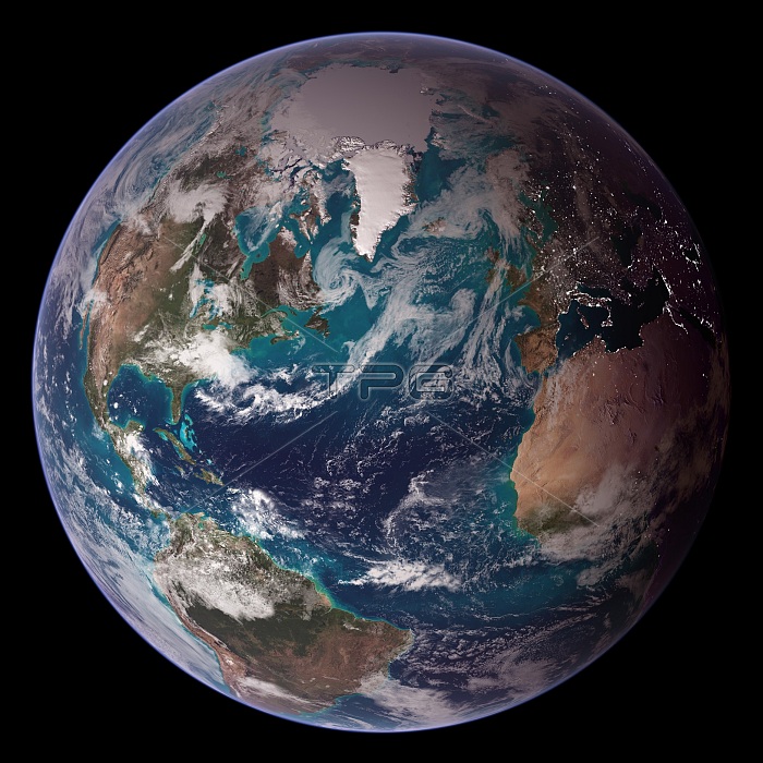
A view of the Earth's Eastern Hemisphere from space composed from various sources. The source images were all acquired from different satellites or missions taken at different times. The image was then pieced together digitally. The satellites used were the Terra MODIS, Aqua MODIS, Defense Meteorological Satellite Program, Radar from the Space Shuttle Endeavor, and the Radarsat Antarctic Mapping Project, version 2. Mission dates range from 1994 to 2004. 1 of 2 (see image # BQ4700).
| px | px | dpi | = | cm | x | cm | = | MB |
Details
Creative#:
TOP22311249
Source:
達志影像
Authorization Type:
RM
Release Information:
須由TPG 完整授權
Model Release:
N/A
Property Release:
No
Right to Privacy:
No
Same folder images:
 Loading