
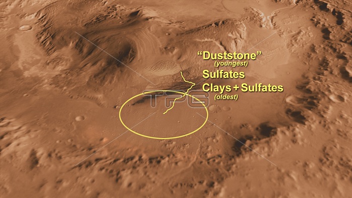
Computer-generated view of Mars' Gale Crater, the intended landing site of the Curiosity rover, created using 3D information from NASA's Mars Orbiter Laser Altimeter; labeled with points of interest to scientists. The landing site is in the smooth area in front of the mound, designated by a yellow circle. The line represents the path of the rover as it examines clays, sulfates and duststone in detail. The minerals reflect changes in the Martian environment, particularly changes in the amount of water on the surface of Mars.
| px | px | dpi | = | cm | x | cm | = | MB |
Details
Creative#:
TOP22311818
Source:
達志影像
Authorization Type:
RM
Release Information:
須由TPG 完整授權
Model Release:
N/A
Property Release:
No
Right to Privacy:
No
Same folder images:
 Loading