
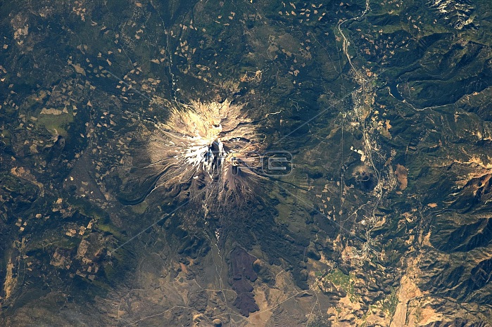
The Cascade Range includes many impressive stratovolcanoes along its north-south extent, some active during the past few hundred years. Mount Shasta in northern California is among the largest and most active (over the past 4,000 years) of the volcanoes in the Cascades. The summit peak stands at an elevation of 4,317 meters (14,160 feet) above sea level, and is formed by the Hotlum cone -- the location of the most recently recorded volcanic activity (in 1786). Shasta's summit is high enough to retain snow cover throughout the year, and several small glaciers are present along the upper slopes. Geologists have mapped prehistoric pyroclastic flow and mudflow deposits (or lahars) from Hotlum cone and the Shastina and Black Butte lava dome complexes to distances of 20 kilometers (12 miles) from the summit of Shasta. As Mount Shasta has erupted within the past 250 years and several communities are within this hazard radius, the U.S. Geological Survey's California Volcano Observatory actively monitors the volcano for signs of activity.
| px | px | dpi | = | cm | x | cm | = | MB |
Details
Creative#:
TOP22313574
Source:
達志影像
Authorization Type:
RM
Release Information:
須由TPG 完整授權
Model Release:
N/A
Property Release:
No
Right to Privacy:
No
Same folder images:
 Loading