
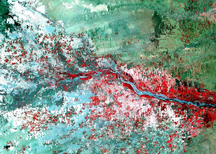
Mosquitoes carry a variety of diseases including malaria, yellow fever, West Nile virus and Rift Valley Fever. Warmer temperatures and increased flooding, both predicted by climate models in some regions, can increase their habitat. In Yemen, an outbreak of Rift Valley Fever in 2000 was linked to widespread flooding in semi-arid areas. The Landsat satellite enabled researchers to target Rift Valley Fever hotspots by looking for potential mosquito habitat in vegetation that had cropped up after the floods. In this false-color image, heavily vegetated areas appear in red. Image taken by the Landsat 7 satellite in September 2000.
| px | px | dpi | = | cm | x | cm | = | MB |
Details
Creative#:
TOP22313739
Source:
達志影像
Authorization Type:
RM
Release Information:
須由TPG 完整授權
Model Release:
N/A
Property Release:
No
Right to Privacy:
No
Same folder images:
 Loading